Geological Fault Lines Guiding Underground Water Flows That Shape Root Depths and Flavor Layers in Austria's Scattered Southern Vineyard Zones
Geschrieben von Dana Braun · 2.11.2026
Geological Fault Lines Guiding Underground Water Flows That Shape Root Depths and Flavor Layers in Austria's Scattered Southern Vineyard Zones
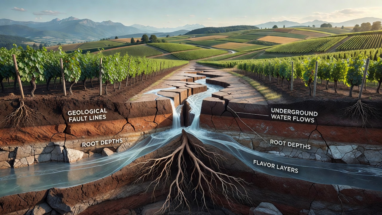
The southern vineyard zones of Austria stretch across parts of Styria and into adjacent Carinthian pockets where tectonic activity has left a network of fault lines that continue to direct subsurface water movement. These fractures, formed over millions of years during Alpine uplift, create pathways that channel groundwater toward or away from vine roots depending on local rock permeability and sediment layers. Data from regional surveys show that water availability at different depths directly influences how far roots extend and which mineral compounds reach the grapes.
Mapping Fault Systems in Southern Growing Areas
Geologists have documented several active and inactive fault lines running through the southern districts, including segments of the Periadriatic Lineament and smaller transverse faults that intersect vineyard parcels at varying angles. Researchers at institutions such as the University of Natural Resources and Life Sciences Vienna have mapped these structures using seismic data and borehole records, revealing that water tends to pool along certain fault planes while draining rapidly along others. In zones where faults intersect softer sedimentary deposits, moisture accumulates at moderate depths, allowing roots to spread laterally rather than plunging deep.
Those who study terroir note that the distribution of these water channels creates distinct moisture gradients across short distances, even within single vineyard sites. One study released in late 2025 by Austrian geological teams highlighted how fault-guided seepage supplies consistent hydration during dry summer months in selected southern plots, while neighboring blocks experience quicker drainage because their underlying faults tilt away from the surface.
Water Flow Patterns and Root Development
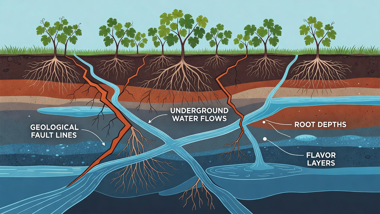
Underground water movement along fault lines determines the vertical reach of vine roots in these southern areas. Where faults permit steady seepage from higher elevations, roots often extend beyond two meters to tap into deeper aquifers, accessing trace elements such as magnesium and potassium that reside in older bedrock layers. In contrast, blocks situated above sealed fault segments show shallower root systems confined to the topsoil and weathered regolith, because water does not penetrate further.
Observations collected over multiple growing seasons indicate that deeper root profiles correlate with slower nutrient uptake rates, which in turn affects the timing of berry maturation. Vines with access to fault-channeled water at depth tend to maintain steadier growth curves through late summer, whereas those restricted to surface moisture display earlier stress responses that alter sugar accumulation patterns. Austrian agricultural monitoring programs continue to track these differences using soil moisture sensors installed at multiple depths along known fault traces.
Influence on Flavor Compound Formation
Flavor layers in wines from these southern zones reflect the varying root depths shaped by fault-controlled hydrology. Grapes grown on vines with access to deeper water sources often carry higher concentrations of certain pyrazines and norisoprenoids because the roots extract compounds from mineral-rich strata below the topsoil. Shallower-rooted vines, by comparison, draw more from organic-rich surface layers, producing profiles dominated by fruit esters and lower mineral notes.
Analyses conducted by regional wine laboratories have quantified these differences across multiple vintages. Samples from fault-adjacent parcels consistently show elevated levels of specific ions that trace back to bedrock types exposed along the fracture planes. The Austrian Federal Geological Survey provides baseline maps that link these ion signatures to particular fault segments, allowing growers to anticipate flavor outcomes based on vineyard position relative to the mapped structures.
Regional Variations Across Southern Districts
Within the scattered southern vineyard pockets, fault orientations create micro-variations that differentiate neighboring sites. In eastern Styrian sections, northwest-southeast trending faults channel water from higher terraces into lower slopes, producing a gradient of root depths that runs perpendicular to the slope direction. Further west, near the Carinthian border, east-west faults intersect volcanic remnants and create isolated pockets of deeper moisture that support older vine plantings with extensive root networks.
November 2026 marks the scheduled release of updated hydrological models from a joint Austrian-Slovenian research initiative that will refine predictions of water movement along these cross-border fault systems. The models incorporate new borehole data collected during the preceding two years and aim to help vineyard managers adjust irrigation planning where natural fault flows prove insufficient during extended dry periods.
Conclusion
Fault lines continue to function as the primary conduits for underground water in Austria's southern vineyard zones, determining root architecture and the mineral pathways that contribute to distinct flavor layers. Ongoing geological mapping and soil monitoring programs supply growers with increasingly precise information about these subsurface dynamics, supporting decisions that align vineyard management with the natural water distribution created by ancient tectonic features.